
ATAK, short for Android Team Awareness Kit, is a map app for Android phones and tablets that gives everyone involved in an operation the same picture: their own teams, hazard areas, photos, video and messages, live and in the right place. It was built for the US military. Today fire services, EMS, police and aid organizations work with the free civilian version, ATAK-CIV.
At a glance
- ATAK shows the positions, markers, routes, photos and chats of all participants on one shared map, offline too.
- The US Air Force Research Laboratory (AFRL) started development in 2010. Today the US government’s TAK Product Center maintains it. The current version is 5.8 (as of October 2026).
- ATAK-CIV is free and open source, available on Google Play and tak.gov.
- The same family includes iTAK (iPhone and iPad), WinTAK (Windows), WebTAK (browser) and TAK Server, which connects devices across networks.
- Without a cellular network, devices exchange data over the local network or mesh radios.
What is ATAK?
At its core, ATAK is a digital map. Every device reports its position at regular intervals, and every marker someone places shows up for everyone else. That lets the app answer four questions that come up in every operation:
- Where are my people?
- Where is the danger?
- What is happening right now?
- What is the plan?
In practice, nobody has to ask for positions over the radio anymore, and a cordon drawn on the map appears on every device at once. For a short overview without the technical detail, see our page What is ATAK?

Where ATAK comes from
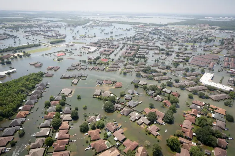
The US Air Force Research Laboratory (AFRL) began developing ATAK in 2010, then under the name Android Tactical Assault Kit. For years, US special operations forces used it in the field and shaped how it evolved. The Department of Homeland Security (DHS) later piloted the software for civilian responders. According to DHS, TAK supported the rescue of more than 2,000 people during seven major hurricanes, among them Harvey, Irma and Maria.
In the civilian version, the T now stands for Team instead of Tactical. After the US Department of Defense published the ATAK-CIV source code in 2020, the app arrived on Google Play the same year. The TAK Server source code has been on GitHub since 2022, and both are licensed under the GPLv3 open source license. The TAK Product Center develops and distributes ATAK and the other TAK products through the tak.gov portal.
New versions come out about three times a year. In October 2026 the current release is ATAK 5.8, with 5.9 announced for November. Google Play sometimes gets new versions later than tak.gov.
ATAK-CIV, ATAK-GOV and ATAK-MIL
ATAK comes in three variants. They work largely the same way and use the same data format, so all three can exchange data with each other. The differences lie in individual features and in who can get which variant.
- ATAK-CIV is the civilian version: free, open source and publicly available. This is where fire services, EMS, public agencies and aid organizations start.
- ATAK-GOV is meant for government agencies and leaves out military-sensitive features.
- ATAK-MIL is reserved for armed forces. Outside the US it is only available through the US government’s Foreign Military Sales program.
iTAK, WinTAK, WebTAK and TAK Server
ATAK belongs to a product family whose programs share one data format and show the same picture.
- iTAK runs on iPhone and iPad and is free on the App Store. It does less than ATAK but covers maps, markers, chat, video and position tracking.
- WinTAK is the Windows client; the civilian version, WinTAK-CIV, is available from tak.gov. A newer addition is TAKX, which combines WinTAK with the command and control program RaptorX.
- WebTAK runs in the browser and is served by TAK Server, so command posts can see the picture without installing anything.
- TAK Server connects devices over cellular, satellite or the internet. It routes messages by group, encrypts connections, stores data packages and links the servers of different organizations through federation.
How to secure a TAK Server is covered in our practical guide to TAK Server security. We run servers in Germany as part of our server solutions.
What ATAK can do in the field
These features come with ATAK out of the box:
- Every device sends its position along with its callsign, team color and role, for example Team Lead or Medic.
- You place markers, draw areas and lines and use tactical symbols. A geofence alerts you when someone enters or leaves an area.
- Tools for distance, bearing, routes and navigation are built in. Bloodhound guides teams to a target, even a moving one.
- In chat you write to everyone, to groups or to individuals. Maps, photos and plans go out as a data package.
- The video player shows streams from drones and cameras, including RTSP, RTMP, SRT and UDP. Our article on video streaming with MediaMTX explains how to get drone footage into the system.
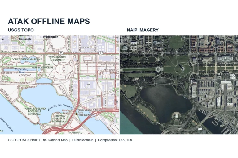
- Besides online maps, ATAK uses your own aerial imagery and offline maps, for example GeoTIFF, MBTiles or GeoPackage. With elevation data it draws elevation profiles and shows which areas are visible from a given point.
- The Alert tool sends an emergency call that everyone sees. You report casualties with the CASEVAC tool using the 9-line format.
Terms such as Bloodhound, data package or MGRS are explained in our TAK glossary.
How devices exchange data
All TAK programs speak Cursor on Target, or CoT. The message format was created at the US research organization MITRE in 2002 and is deliberately simple: each message says what is where and when, with an identifier, a type, timestamps, an expiry time and a position. CoT started out as XML; newer versions send the same content more compactly as Protobuf. Because the format is open, other systems can read and write CoT too, such as drones, sensors or dispatch software. Our technical deep dive into CoT shows how a message is built.
There are two ways to move the data. On the same Wi-Fi or mesh network, devices find each other without a server and send their positions to everyone via multicast. As soon as cellular, satellite or the internet sits in between, traffic runs through a TAK Server, encrypted with TLS.
If the cellular network goes down, for example during a wildfire, in a disaster area or in a tunnel, mesh radios take over. Low-cost LoRa devices running the open source firmware Meshtastic carry positions and short messages. Their data rate is too low for photos or video. Broadband MANET radios handle video as well but cost considerably more. Our comparison of mesh radios shows which devices are permitted in Europe.
Extending ATAK with plugins
Anything the app cannot do on its own comes in through plugins. A plugin is a separate Android app that hooks into ATAK, for example for radios, drones, sensors or specialist software. If a plugin does not match the installed ATAK version, ATAK will only load it after an update. So that you do not have to set up every device by hand, plugins can be distributed centrally through an update server.
AI features can be added the same way, such as object detection in drone video. These are extensions and not part of standard ATAK. Read more in TAK and AI. Manufacturers who want to connect their own device to ATAK will find our offer under plugin development.
Where ATAK helps
- At a wildland fire, incident command sees the vehicles and a drone’s thermal image on the same map. Divisions and hazard areas they draw show up for every crew straight away.
- At a large event, security staff are connected by mesh radio. When a medical emergency comes in, the command post sends the nearest team, and Bloodhound shows them the distance and arrival time.
- An aid organization works in a disaster area without cellular coverage. Helper positions, safe routes and the status of shelters still appear on the map, carried over LoRa radio.
- In policing, patrol units, roadblocks and the feed from a helicopter or drone come together in one common operating picture.
You will find more examples by type of organization under Sectors.

What you need to get started
Installing the app takes a few minutes. Using it across an organization takes more:
- Devices: Android phones or tablets, ideally rugged models for outdoor use. The TAK Product Center tests ATAK mainly on Samsung devices.
- Maps: offline maps and elevation data for your area, loaded onto the devices in advance.
- Server: a TAK Server with certificates, users and groups, hosted or on your own hardware.
- Radio: mesh radios if you need to work without a cellular network.
- Training and operations: exercises for users and administrators, plus updates several times a year.
Our ATAK tutorial for beginners shows how to install ATAK and connect your first devices.
TAK Hub sets up TAK Servers and runs them in Germany, puts together field-ready hardware and offers training and workshops for users and administrators. What a project costs and how it runs is explained under Costs and process.
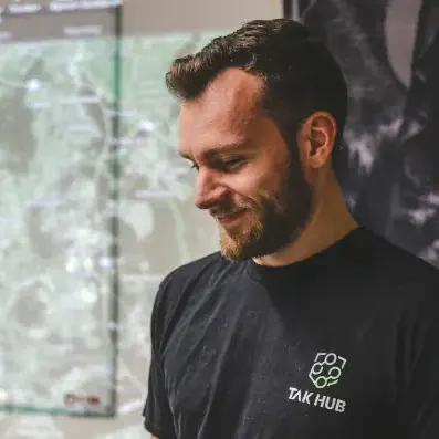
Marcel Neuroth Founder and Managing Director, TAK Hub
Marcel Neuroth is the founder and managing director of TAK Hub. He served as a soldier in Afghanistan and then studied mechatronics. In Ukraine he volunteered and later coordinated operations as a mission leader, including evacuations near the front line. He used ATAK himself on these missions. Today he and his team set up TAK systems for emergency services, train their personnel and support projects in Europe, Latin America and Southeast Asia.